Locating a National Collection - Locolligo
Locolligo is a browser-based tool which has been prototyped by Locating a National Collection (LaNC) for the conversion of simple spreadsheet data into a format that can be mapped using Peripleo. Locolligo also provides both manual and automatic processes for rich linking to other datasets and web resources.
Main Features
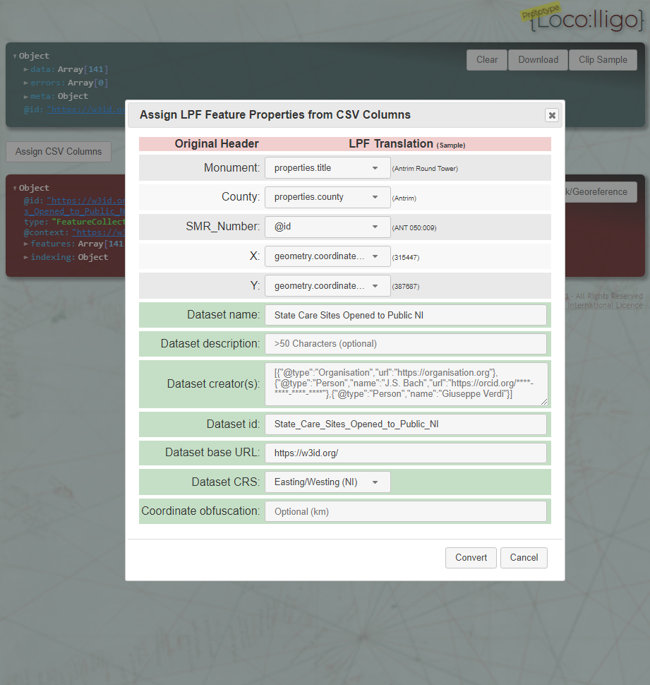
- Upload data in CSV format (exported, typically, from a spreadsheet), customise its transformation to Linked Places Format (LPF), and download the transformed data for use in Peripleo. A validation report is provided to assist with refinement of the dataset.
- Preconfigured to transform coordinates to WGS84 (web mapping standard reference system) from OSGB (Ordnance Survey) and both GB and Northern Ireland easting/westing formats. Coordinates can also be obfuscated to conceal, for example, the exact location of archaeological findspots.
- Embedding of Google-indexable schema.org metadata, including citations, licensing information, and an automatically-generated bounding box to indicate geographic coverage of the dataset.
- Automatic generation of UUIDs (unique identifiers) for features, which in combination with w3id.org configuration can be used to generate web-referenceable PIDs (persistent identifiers) for the dataset and each of its constituent features.
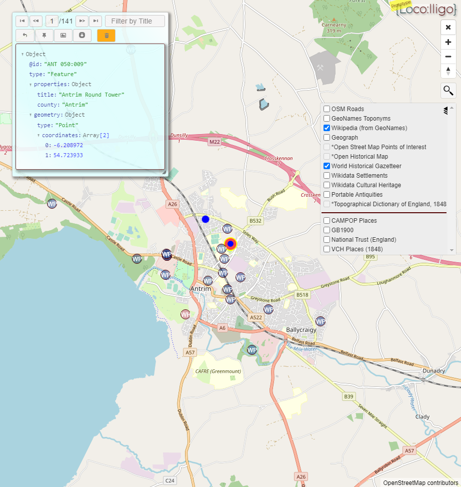
- Map visualisation of the transformed dataset, with configurable basemaps.
- Search for place-names within map bounds using an online geolocation service.
- Georeferencing capability to generate coordinates for features lacking location data, and for correcting inaccurate coordinates.
- Automatic and manual location-based linking to a configurable and extensible range of geodata APIs, including Wikidata Settlements, Geograph images, Wikipedia articles, and archaeological finds.
- Capability to store transformed LPF datasets to a local ‘GeoData Library’ which can then be linked to other datasets.
- Rudimentary (but developable) functionality for both automatic and manual linking of dataset properties to standard web-based vocabularies such as Wikidata.
Locolligo has been essential to the successful and speedy production of LPF datasets, and their agile reformatting to accommodate problems detected during the development of Peripleo. Its development beyond the current prototype is, however, beyond the scope of LaNC.